Drone Performance Monitoring
Monitoring and maintenance are essential components of successful mine site rehabilitation programs. Monitoring should be in place in order to assess early rehabilitation success, reveal the need for any remedial actions and determine whether rehabilitation is likely to meet long term goals. Progressive evaluation of rehabilitation efforts reduces the detrimental risk of the credibility of science and outlines the best practises of mine rehabilitation. The ongoing evaluation and monitoring are essential to better understanding rehabilitation practices and how to guide them towards success.
The use of unmanned aerial vehicles, commonly referred to as drones, is swiftly becoming a revolutionary tool for gaining knowledge about the development of revegetated areas.
SPRAY GRASS AUSTRALIA AND DRONES
As well as innovating through its focus on soil health, Spray Grass Australia uses the latest in drone and imaging technology. At the beginning of a project, drones are utilised to provide 3D modelling, area monitoring and image mapping, which along with soil testing, allows us to map the area to be rehabilitated to a high degree of detail. A detailed map of the site ensures that we are able to apply hydroseeding, hydromulching and dust suppression solutions with precision and accuracy, ensuring that all areas are covered evenly and at specified rates.
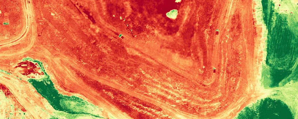
By utilising one of the latest industrial drones available in Australia, we are able to take advantage of multispectral and thermal imaging cameras and sensors on drones to gain a deeper understanding on how the plants are performing. The use of NDVI – Normalised Difference Vegetation Index – in conjunction with drone sensors is the classic indicator of plant health, allowing us to maximise efficiency. In technical terms, the basic principle of NDVI relies on the fact that leaves reflect extensive amounts of light in the Near Infrared (NIR). When the plant becomes dehydrated or stressed, the spongy layer collapses and the leaves reflect less NIR light. Thus, mathematically combining these two signals can help differentiate plant from non-plant and healthy plant from sickly plant. Once this is constructed, we can analyse NDVI images for a range of indicators of vegetation status and plant vigour. Specifically, we can analyse contrasting areas of plant vigour and can cover large inaccessible areas of land for analysis.
Multiple sensors and bands including red, green, blue, red edge and near-infrared, come together to allow us to see many different analytical layers which are optimal in sensing health. We can see areas that are under heat and drought stress and can even asses plant height, nitrogen and chlorophyll content in the plant leaves; all direct indicators of plant health. We are able to monitor the sowing quality, growth rate, the counted number and planned number of plants, we can also undertake plant disease analysis and pest detection, allowing us to maximise growth efficiency.
Do you have an upcoming Rehabilitation or Revegetation project?
Contact our expert team at Spray Grass Australia for information about our Rehabilitation & Revegetation solutions and an obligation-free quote.
Related Posts
What is Dust Suppression?
Dust is a common health and environmental problem anywhere in the world, which is why...
read more
Why is Erosion Control Important?
Soil erosion is one of the top 10 soil threats in the world, as a...
read more
The Importance of Timing Revegetation Projects
The key to a successful revegetation project rests in the timing and identifying the perfect...
read more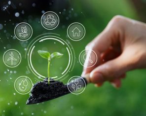
4 Reasons to Focus on ESG
Environmental, Social, and Governance (ESG) isincreasingly gaining traction. Due to climate change and environmental concerns,...
read more